Lava erupts from Fissure 17 and volcanic bombs 2–3 m in size are thrown 125 m (400 ft) into the air.
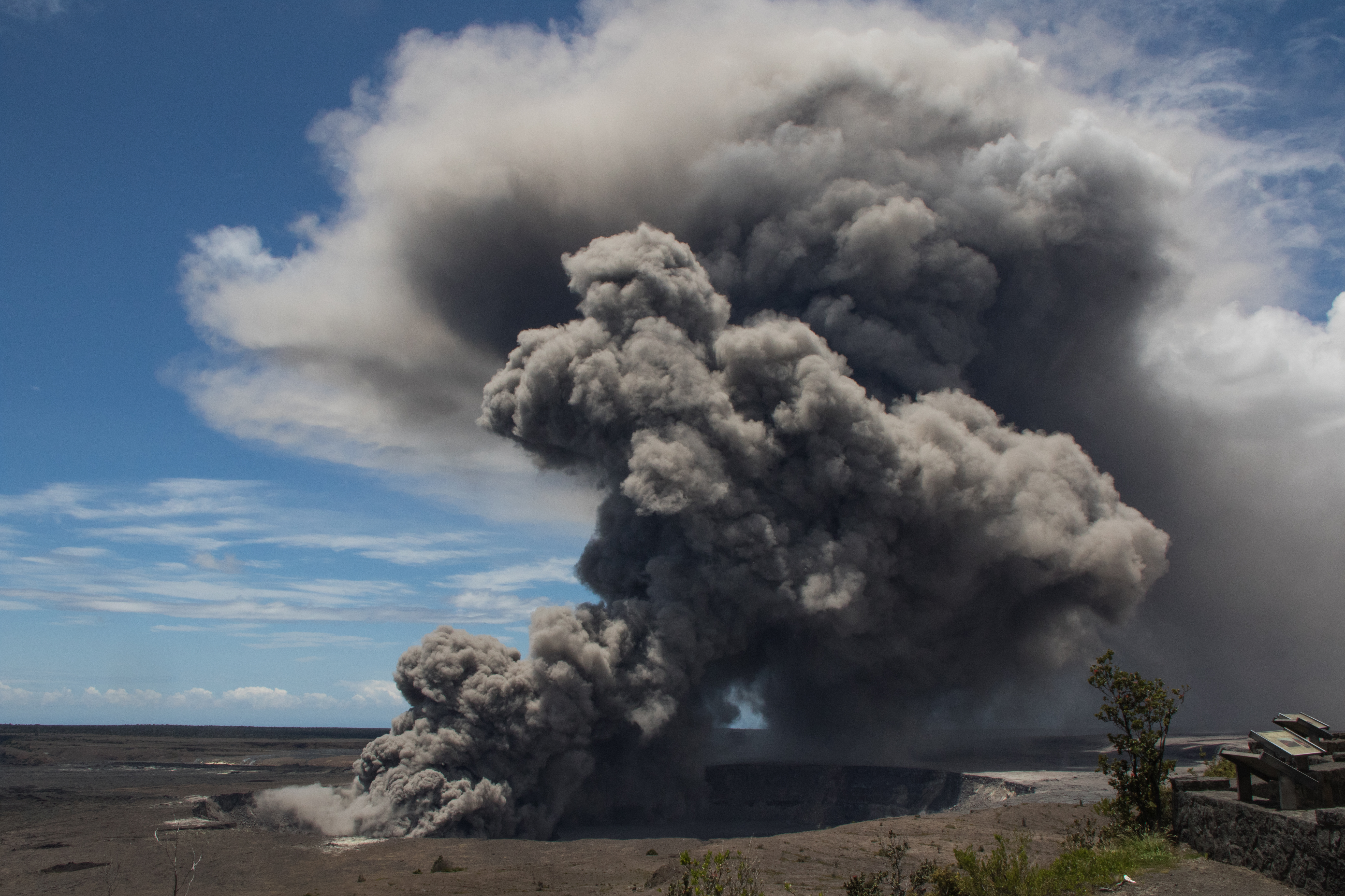
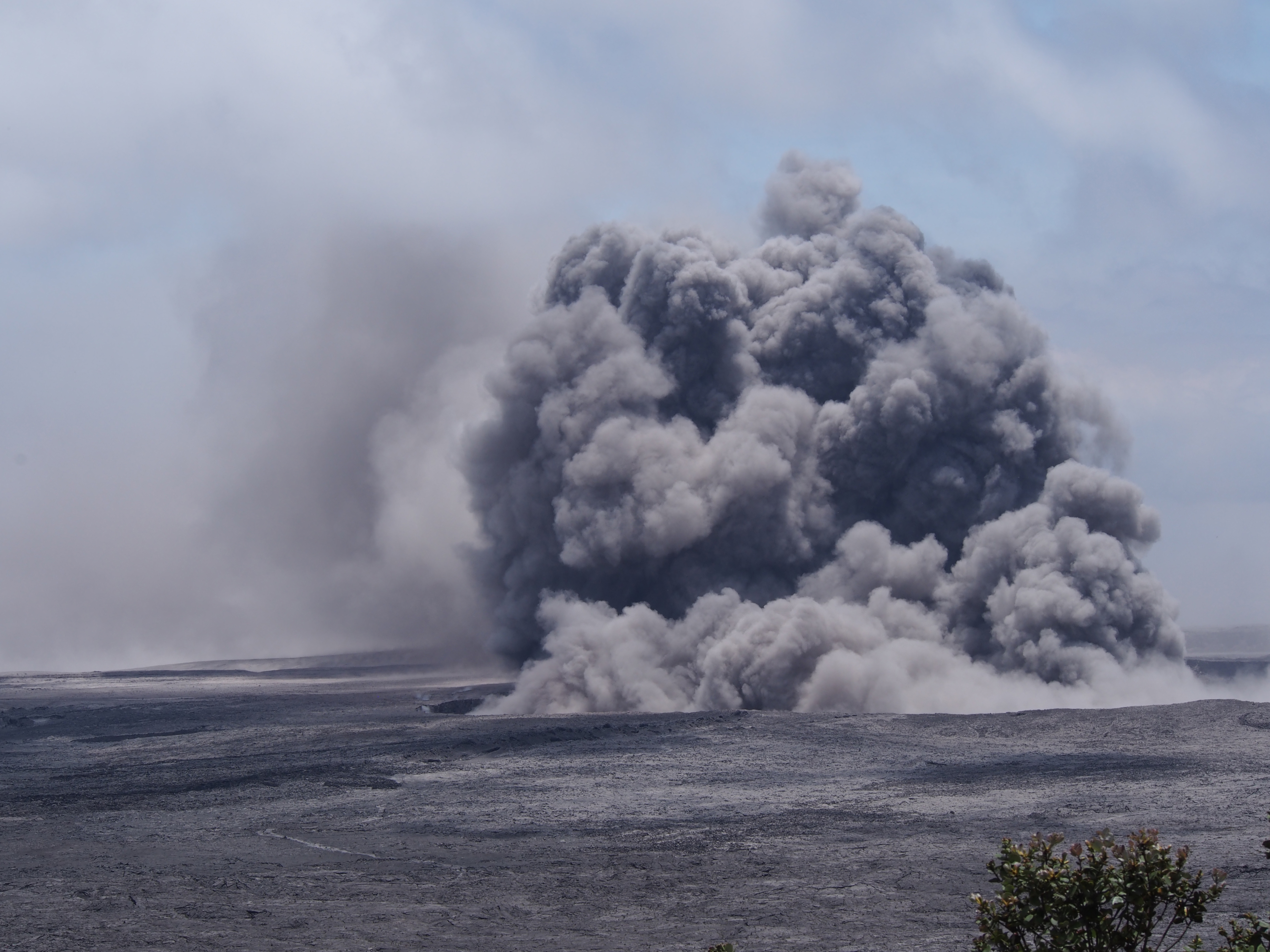
May 15, 2018
Rockfalls and explosions within Halemaʻumaʻu Crater cause an ash plume that rises more than 3 km (1.9 mi) above sea level.
May 16, 2018
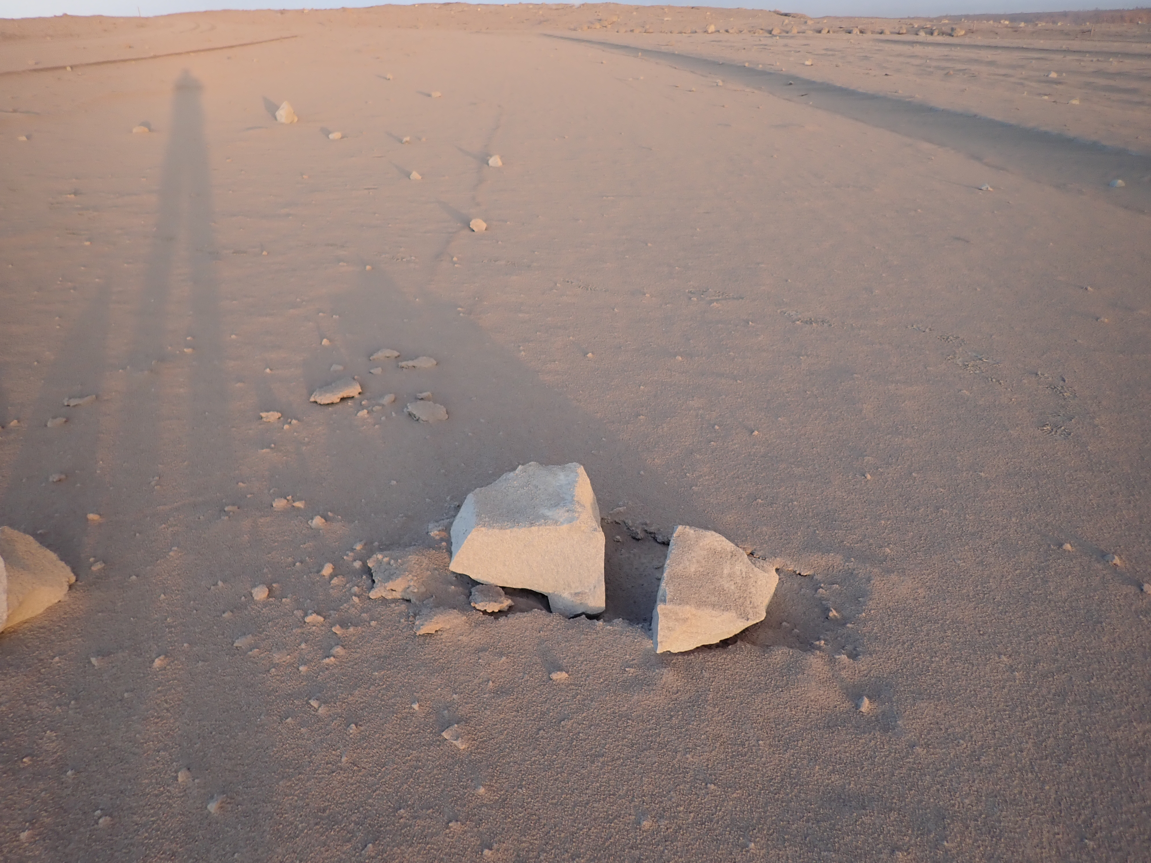
Rock and ash from an explosion in the summit crater cover a nearby parking lot. The rock was about 60 cm before it broke on impact.
May 17, 2018
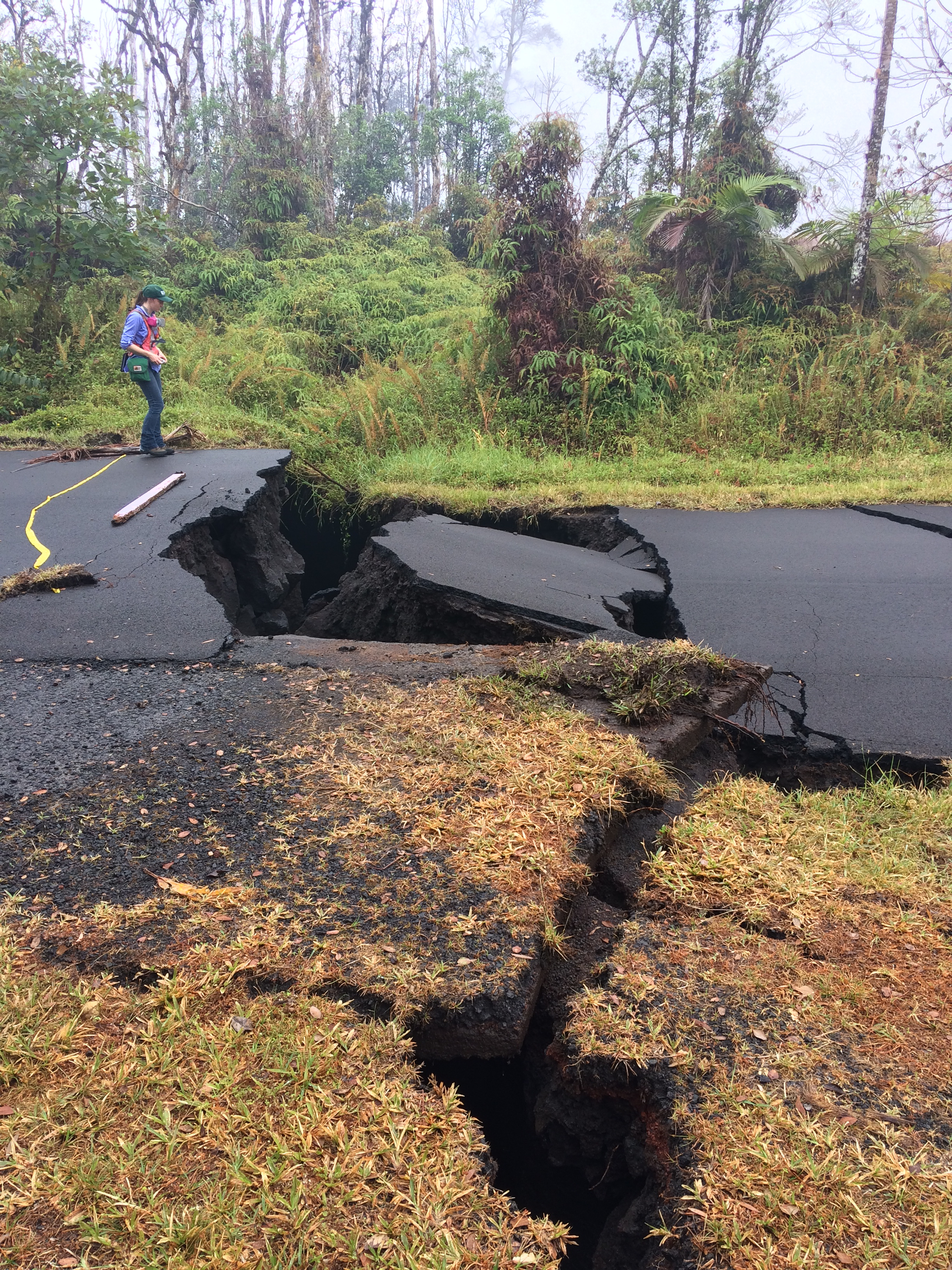
A geologist observes cracks on a Street in Leilani Estates. These cracks expanded significantly in the past day.
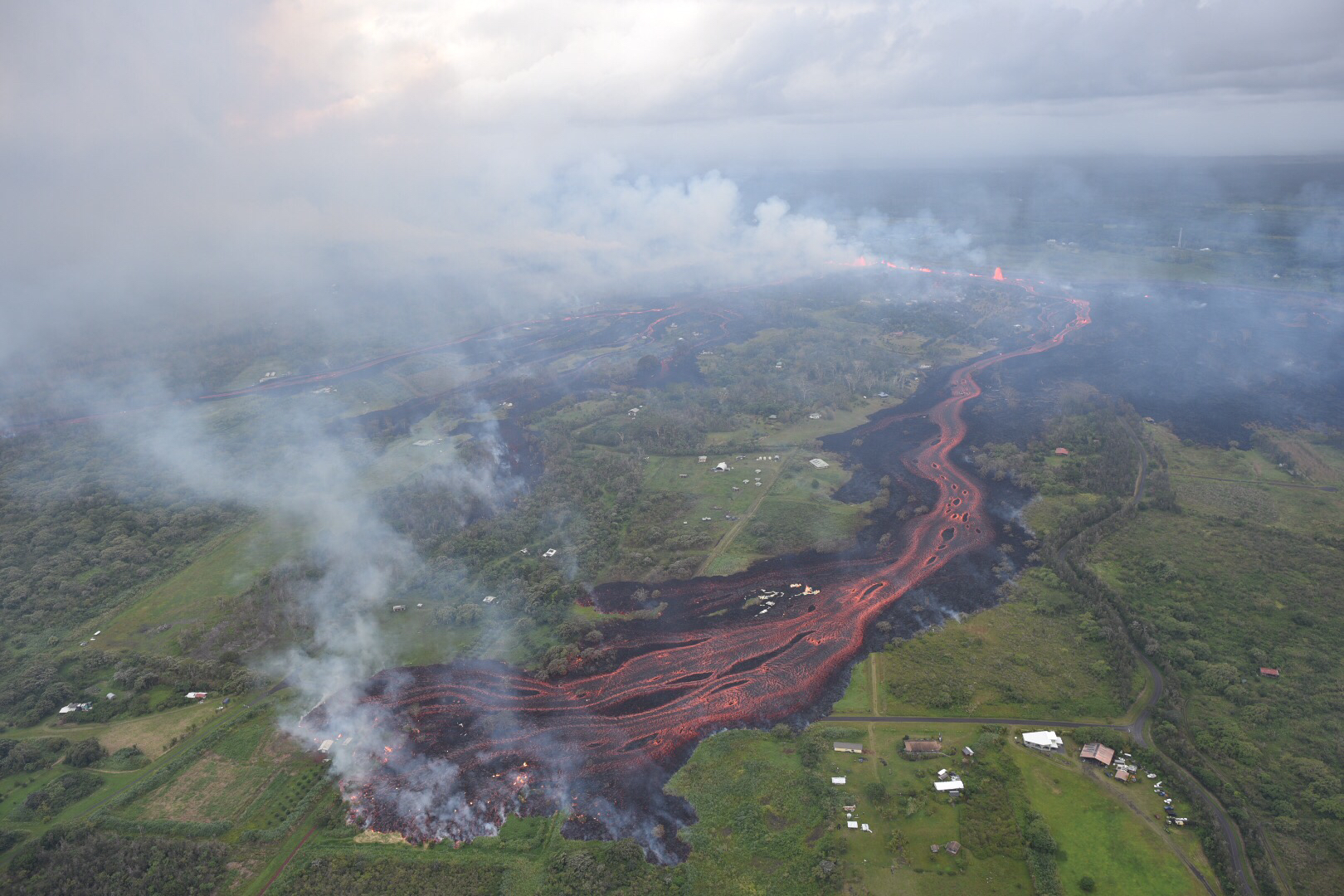
May 19, 2018
Lava fountains erupt from Fissure 20 in Kīlauea Volcano’s lower East Rift Zone.
May 19, 2018
Lava flows from Fissure 16-20 (in the upper right) form channels.
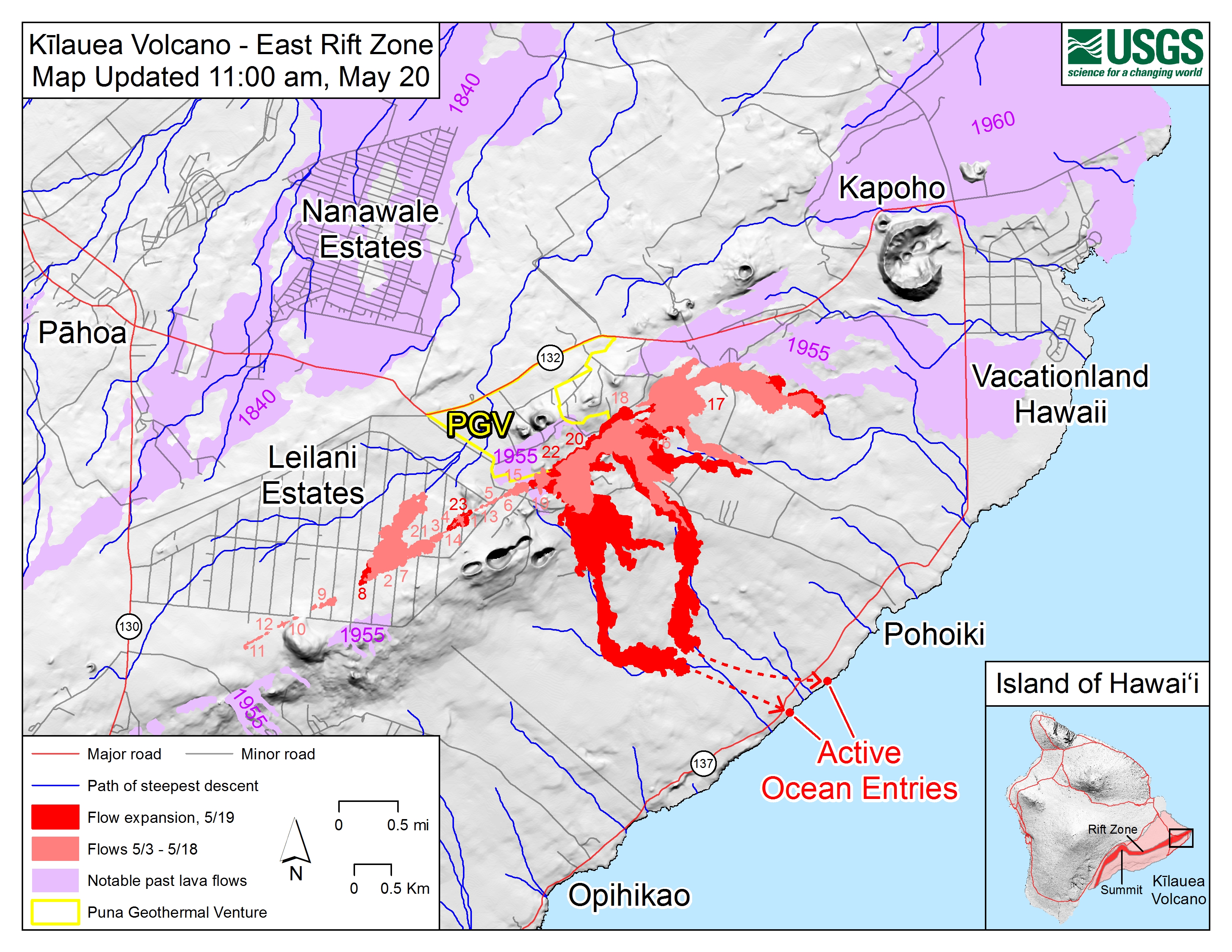
May 20, 2018
This map shows lava flows from May 3 to May 19. Dark red shows the expansion on May 19. Purple areas indicate past lava flows.
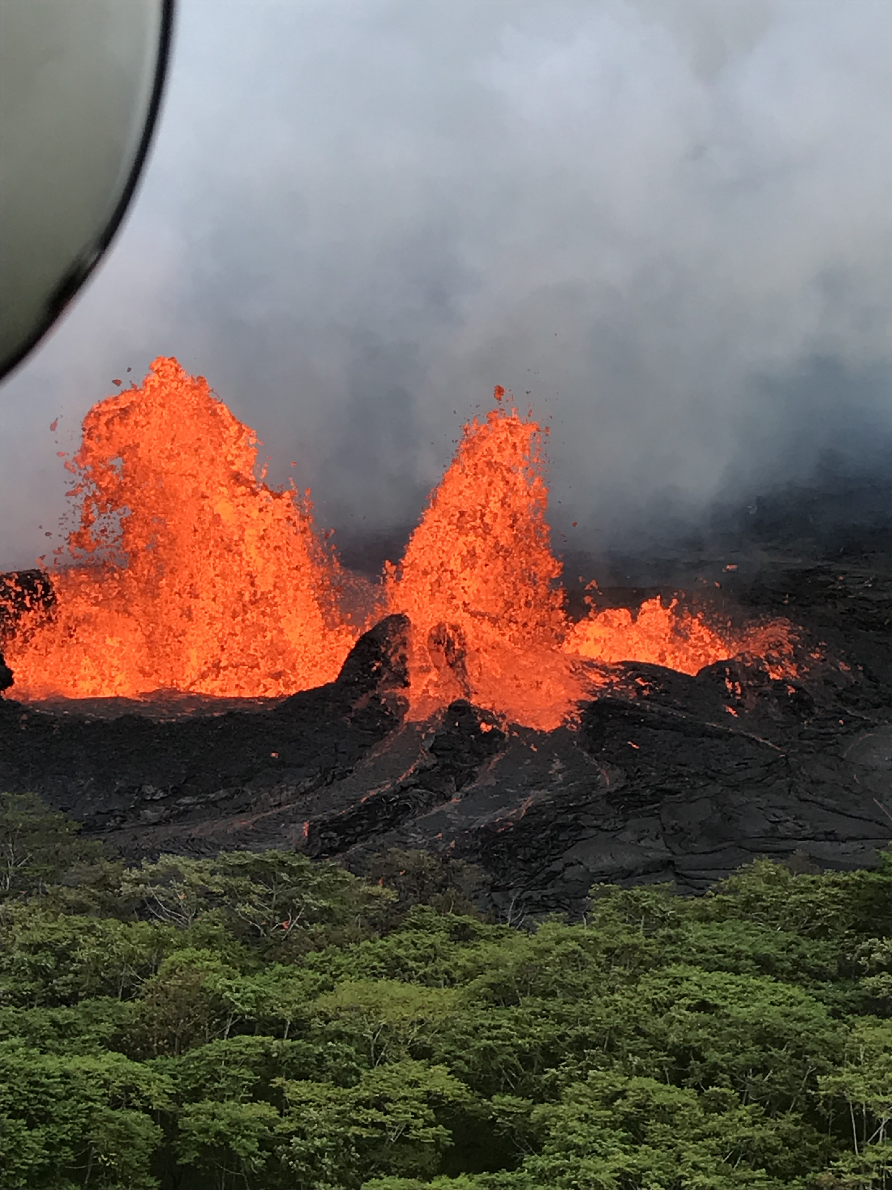
May 21, 2018
Lava fountains erupt at Fissure 22.
May 23, 2018
Multiple explosions occur at Kīlauea’s summit throughout the day. Ash plumes rise about 1,800 to 2,100 m (6,000 to 7,000 ft) above sea level.
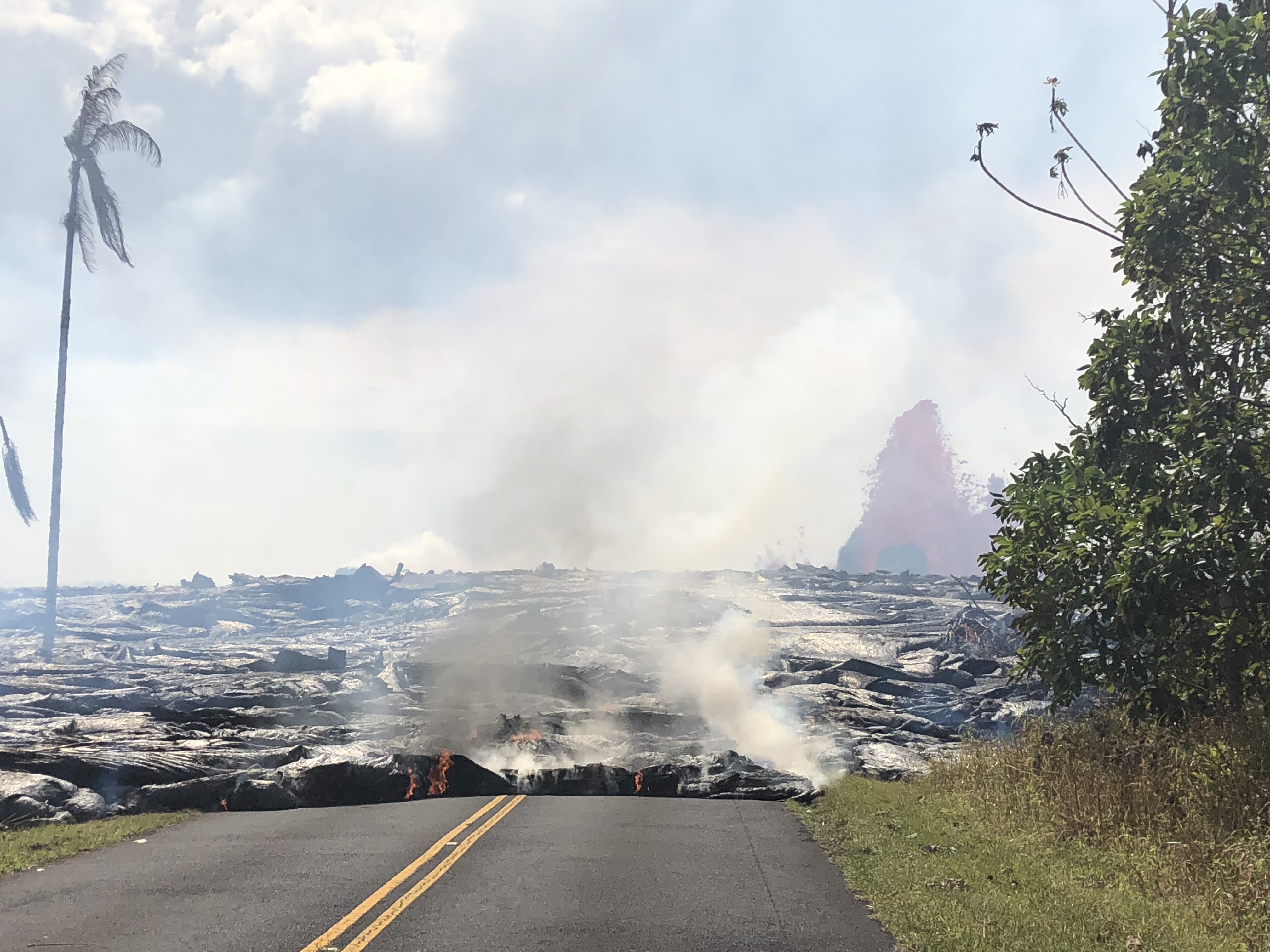
May 27, 2018
A lava flow advances west from Fissure 7 on Leilani Avenue. Overnight, lava fountains (seen in the background) reached 50 to 60 m (164 to 197 ft) high.
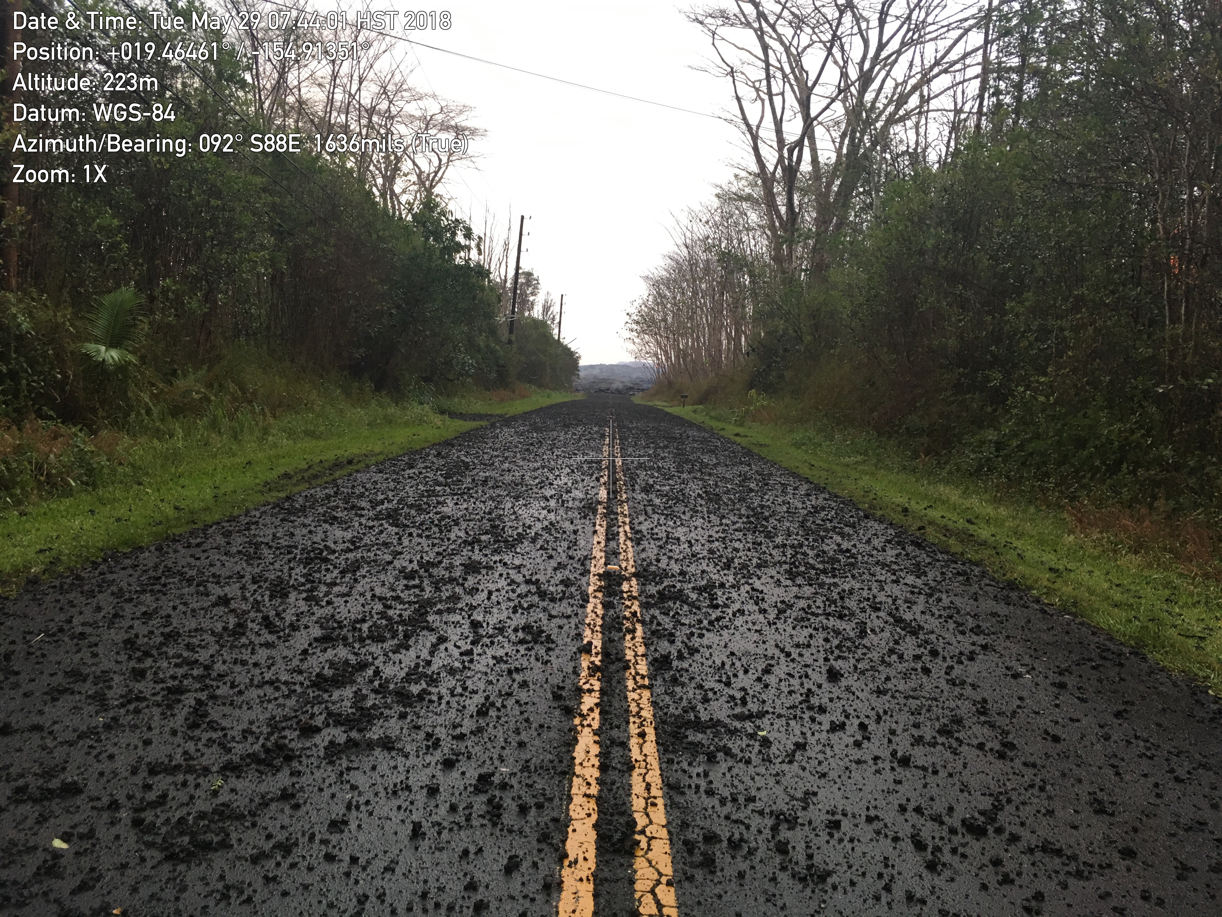
May 29, 2018
Tephra from the lava fountains of Fissure 8 covers Leilani Avenue in the Leilani Estates neighborhood.
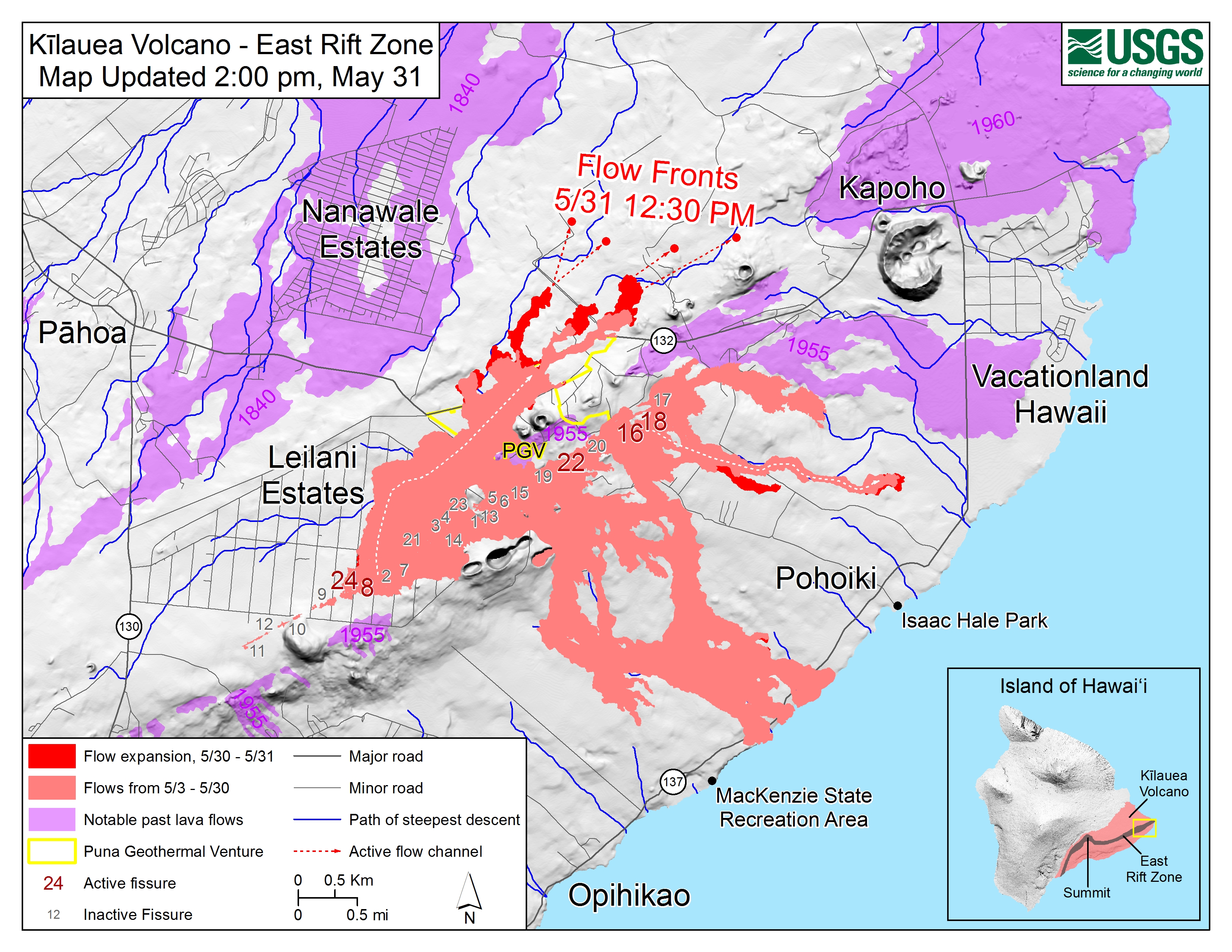
May 31, 2018
This map shows lava flows from May 3 to May 31. Dark red shows the expansion on May 30–31. Purple areas indicate past lava flows.
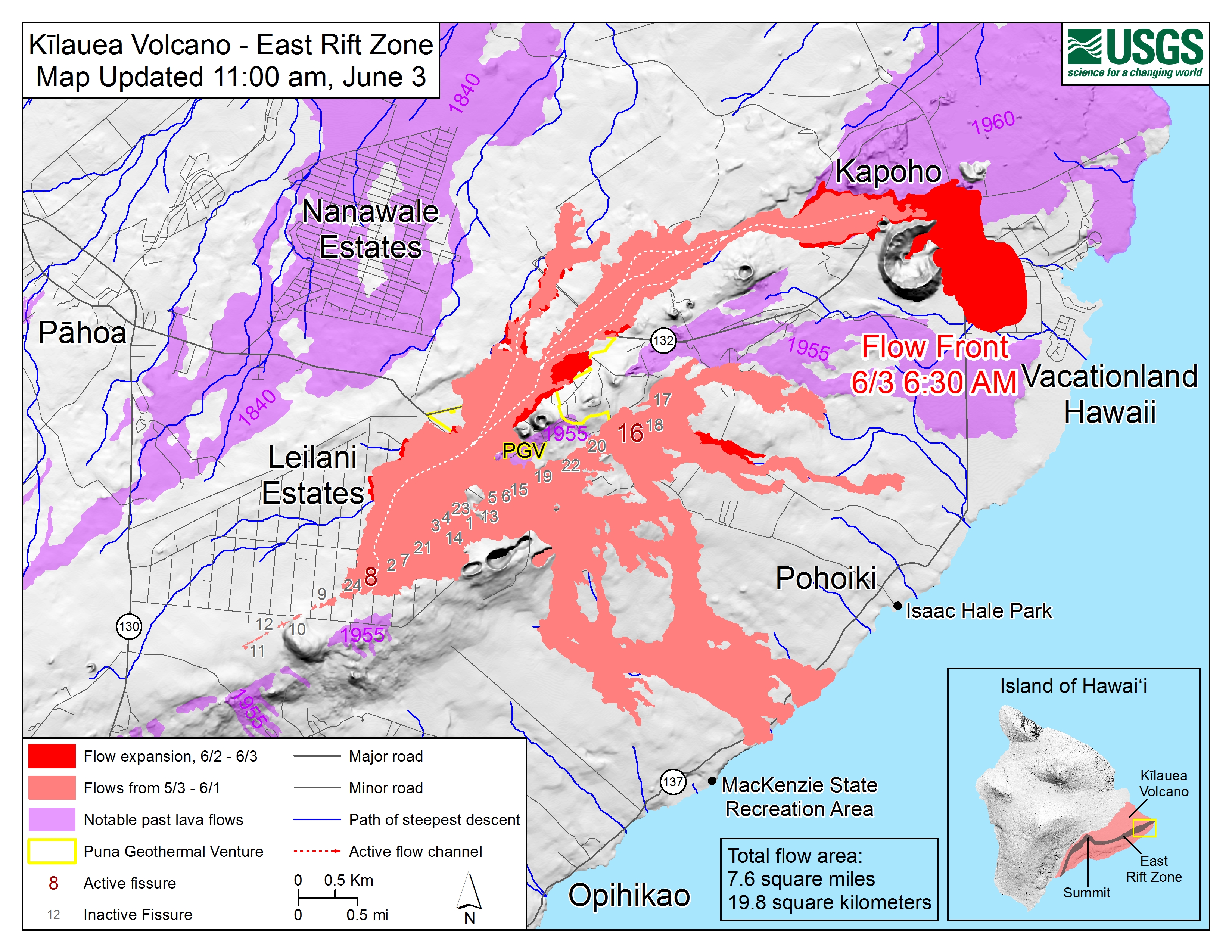
June 3, 2018
This map shows lava flows from May 3 to June 3. Dark red shows the expansion on June 2–3. Purple areas indicate past lava flows.
June 3, 2018
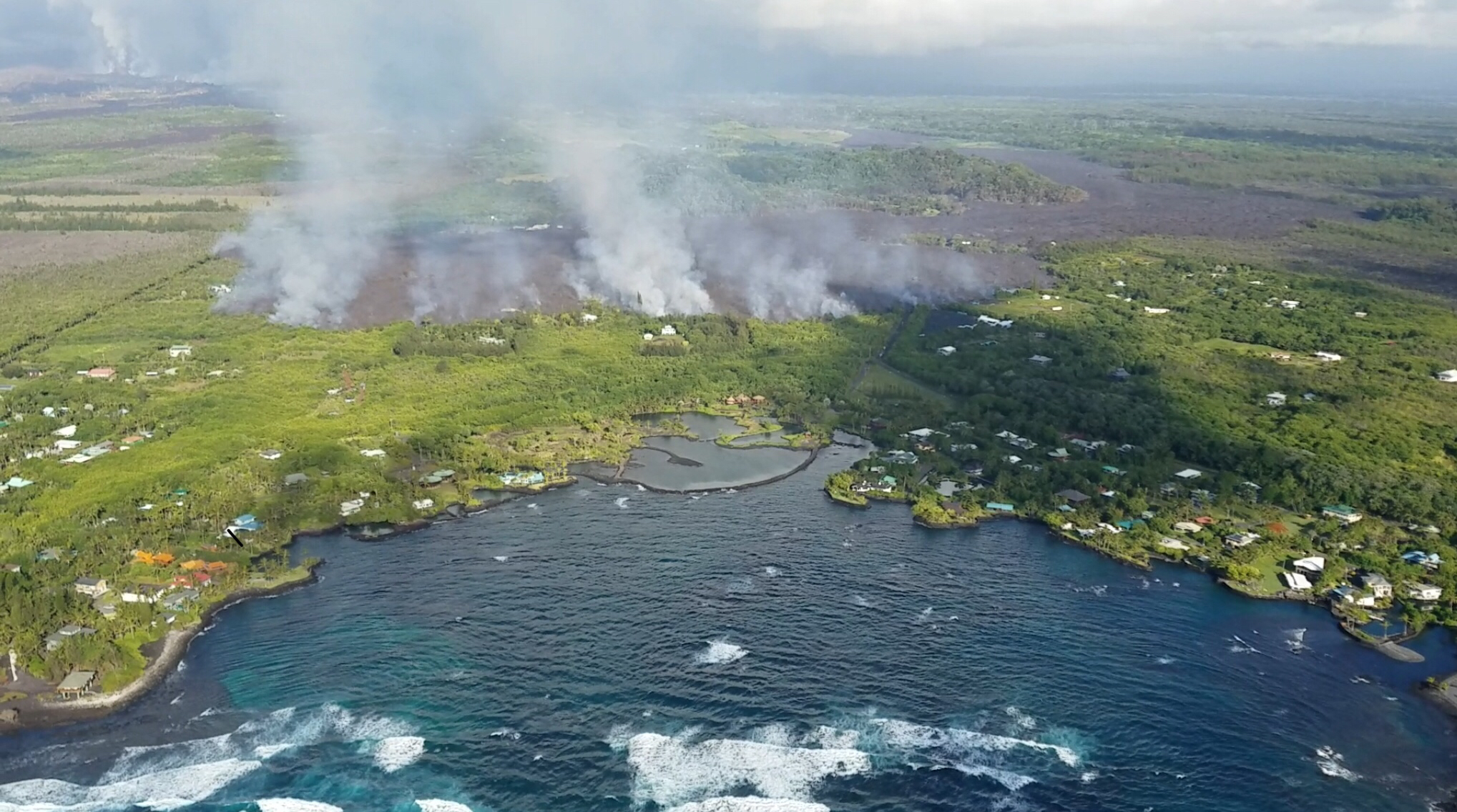
The lava flow from Fissure 8 advances toward the ocean at Kapoho Bay.
June 4, 2018
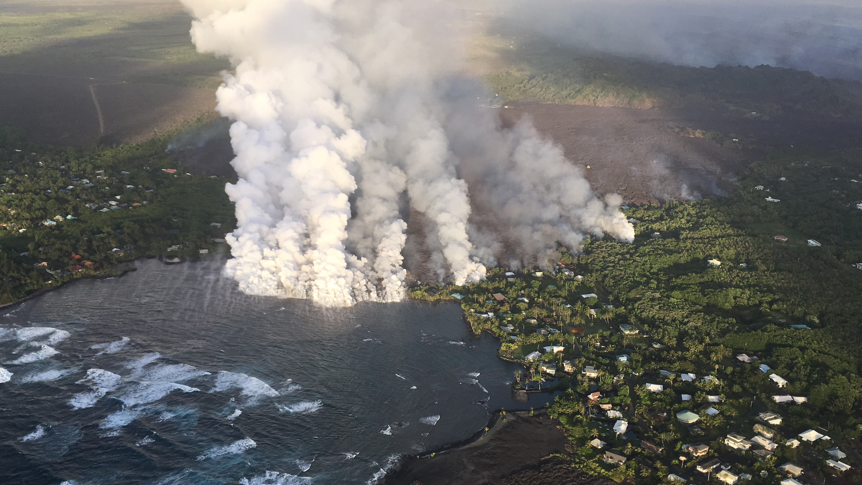
The lava flow from Fissure 8 enters Kapoho Bay.
June 4, 2018
The lava flow from Fissure 8 enters Kapoho Bay.
June 5, 2018
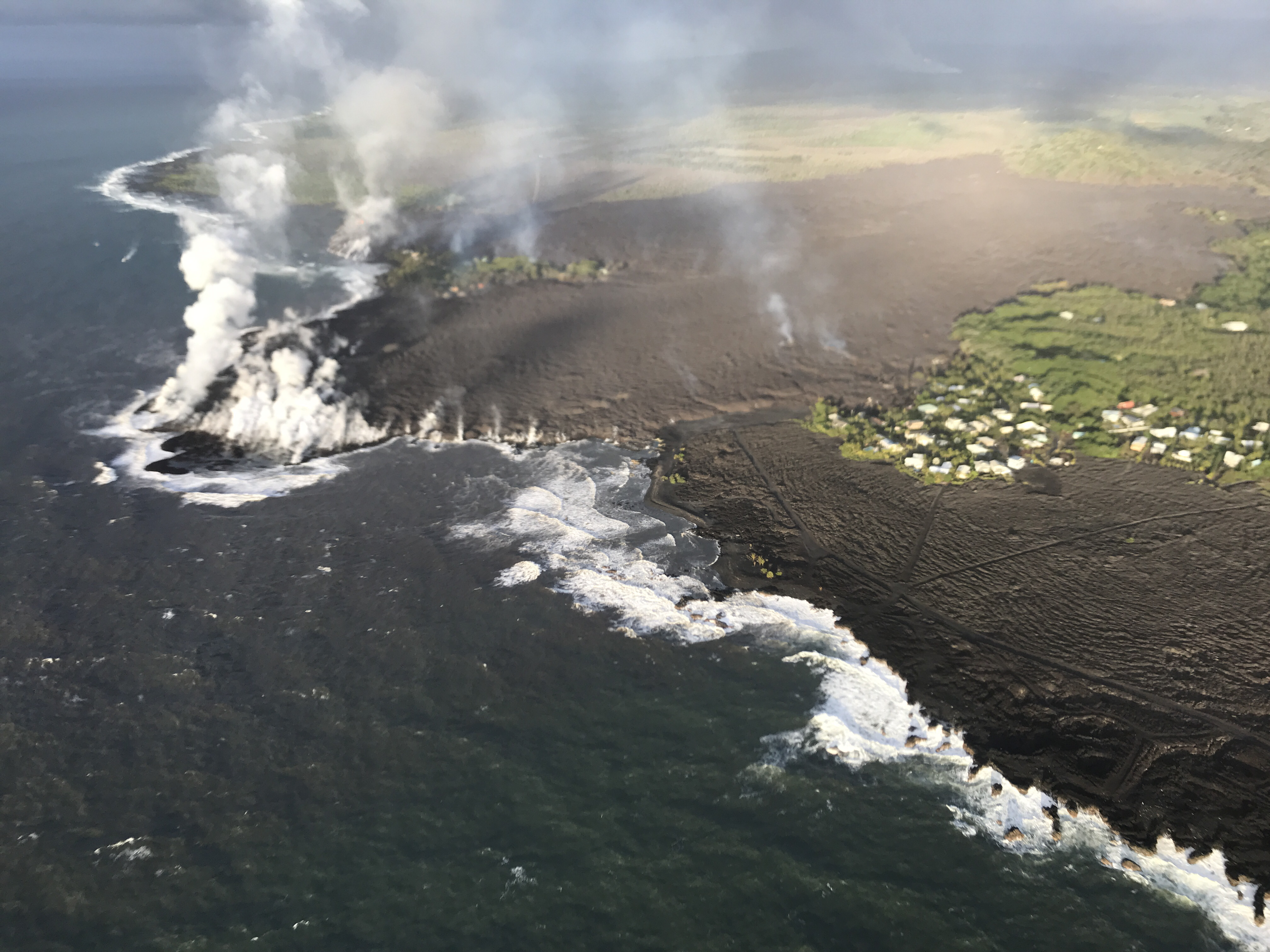
By the morning of June 5, the Fissure 8 lava flow front has completely filled Kapoho Bay.
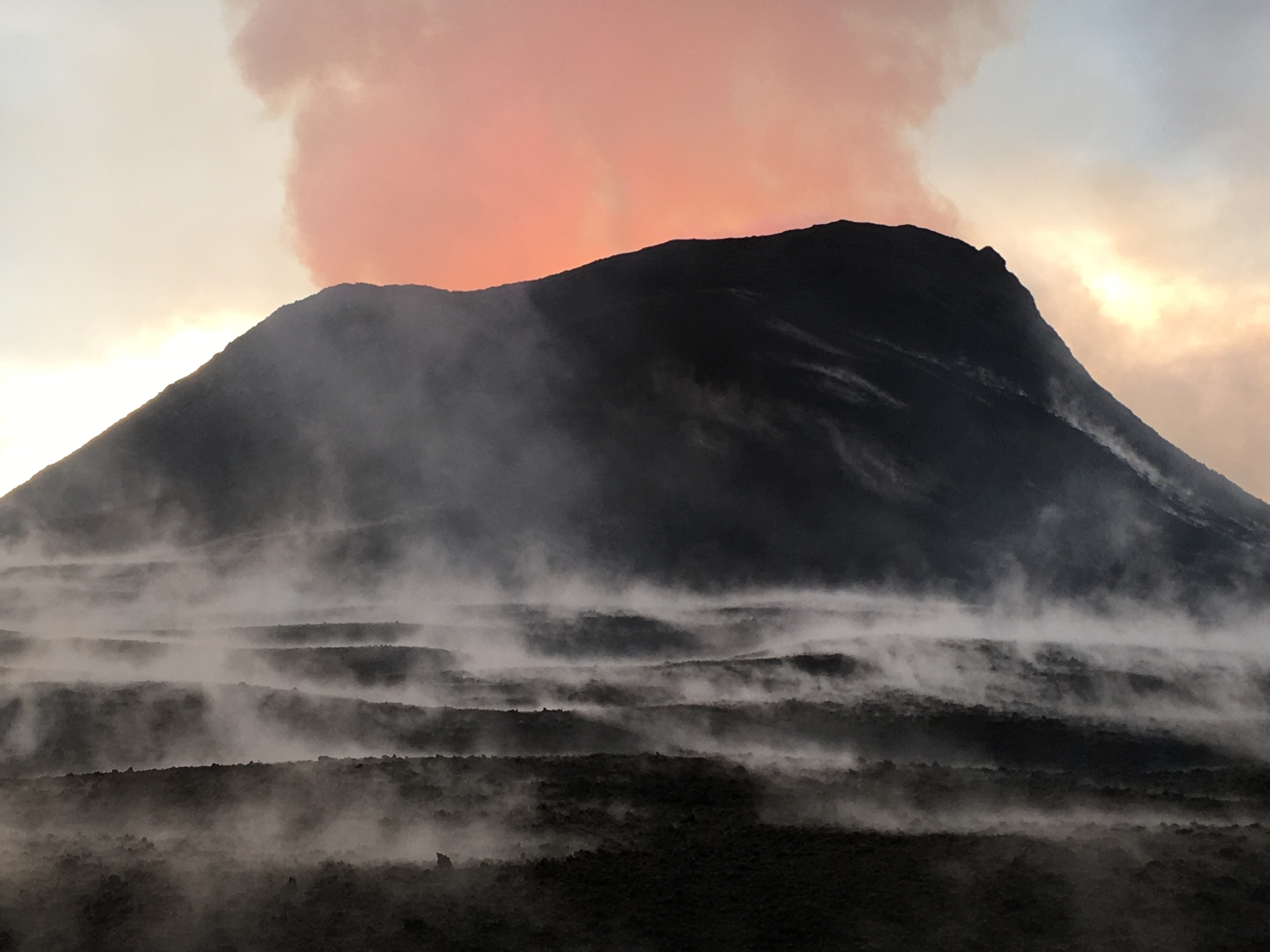
June 5, 2018
Explosions and collapse have enlarged the crater that previously held a lava lake. The far rim has dropped due to deflation. A parking area that has been closed since 2008 can be seen to the left.
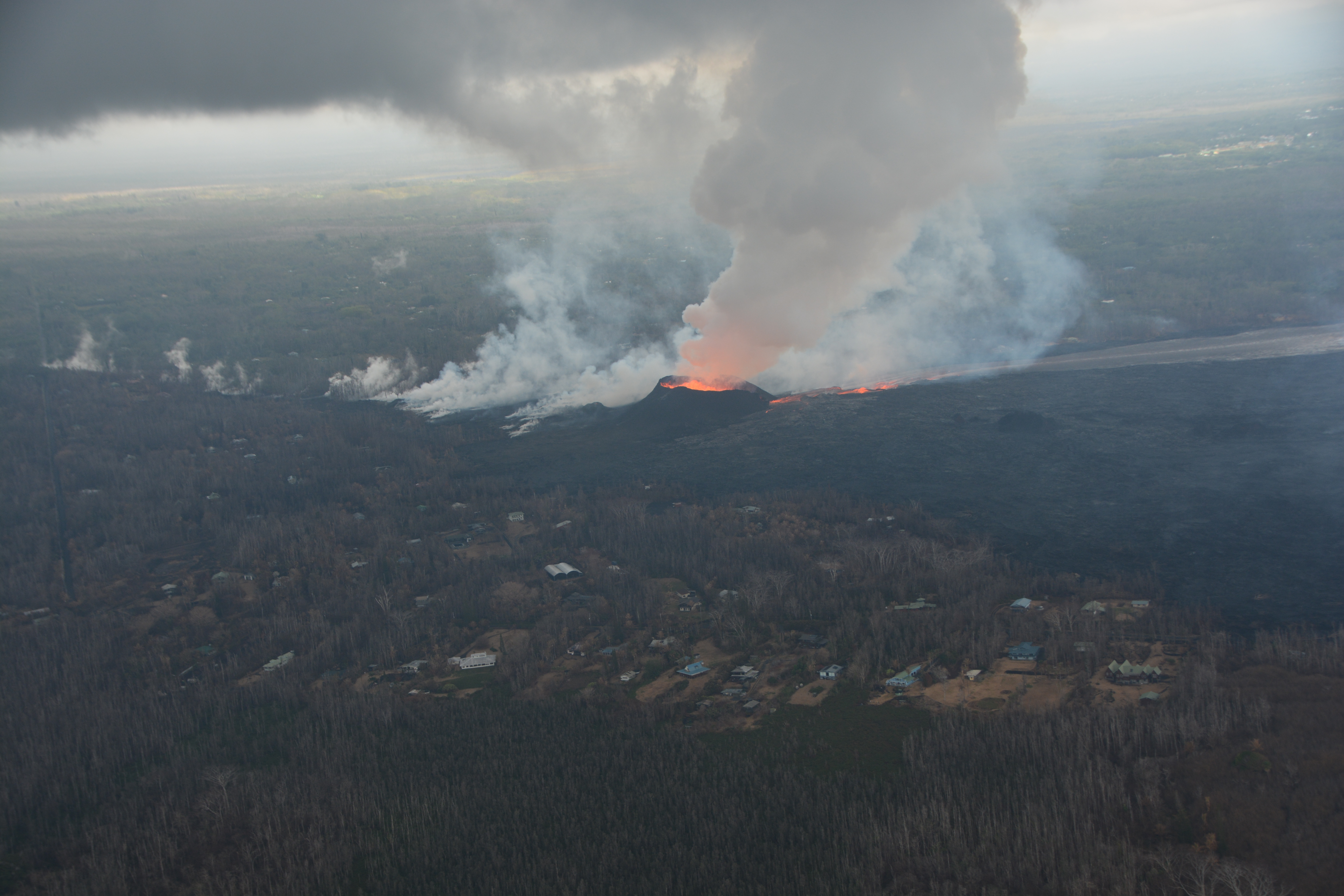
June 6, 2018
A helicopter overflight shows lava flow from Fissure 8 to the ocean.
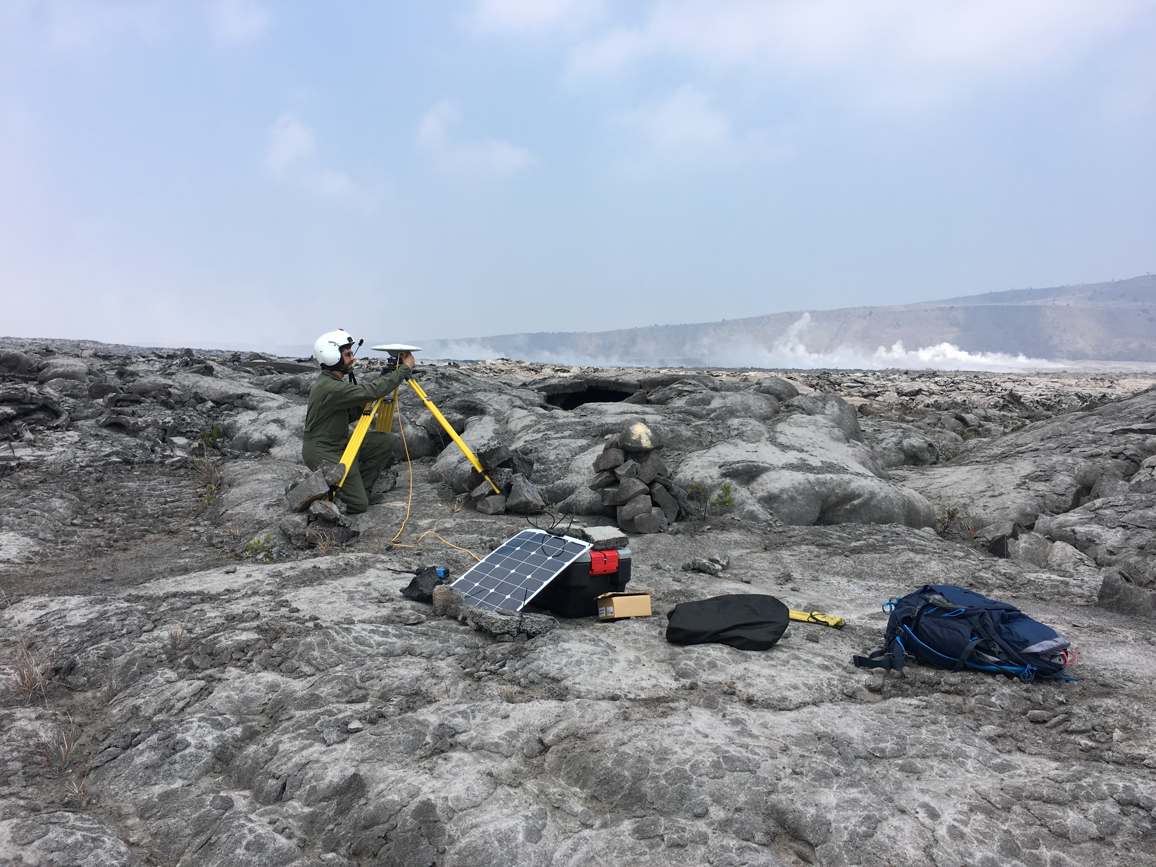
June 9, 2018
Geologists install additional GPS stations around Halemaʻumaʻu Crater to better monitor and measure the ongoing changes in the crater and the caldera floor.
June 13, 2018
Fissure 8 lava fountains continue to reach heights of 40-45 m (130-150 ft). The fissure has built a cone of cinder and spatter, which is now about 40 m (130 ft) at its highest point.
June 16, 2018
Spattering from Fissure 8 has built a cinder cone that is now 51 m (170 ft) tall at its highest point.
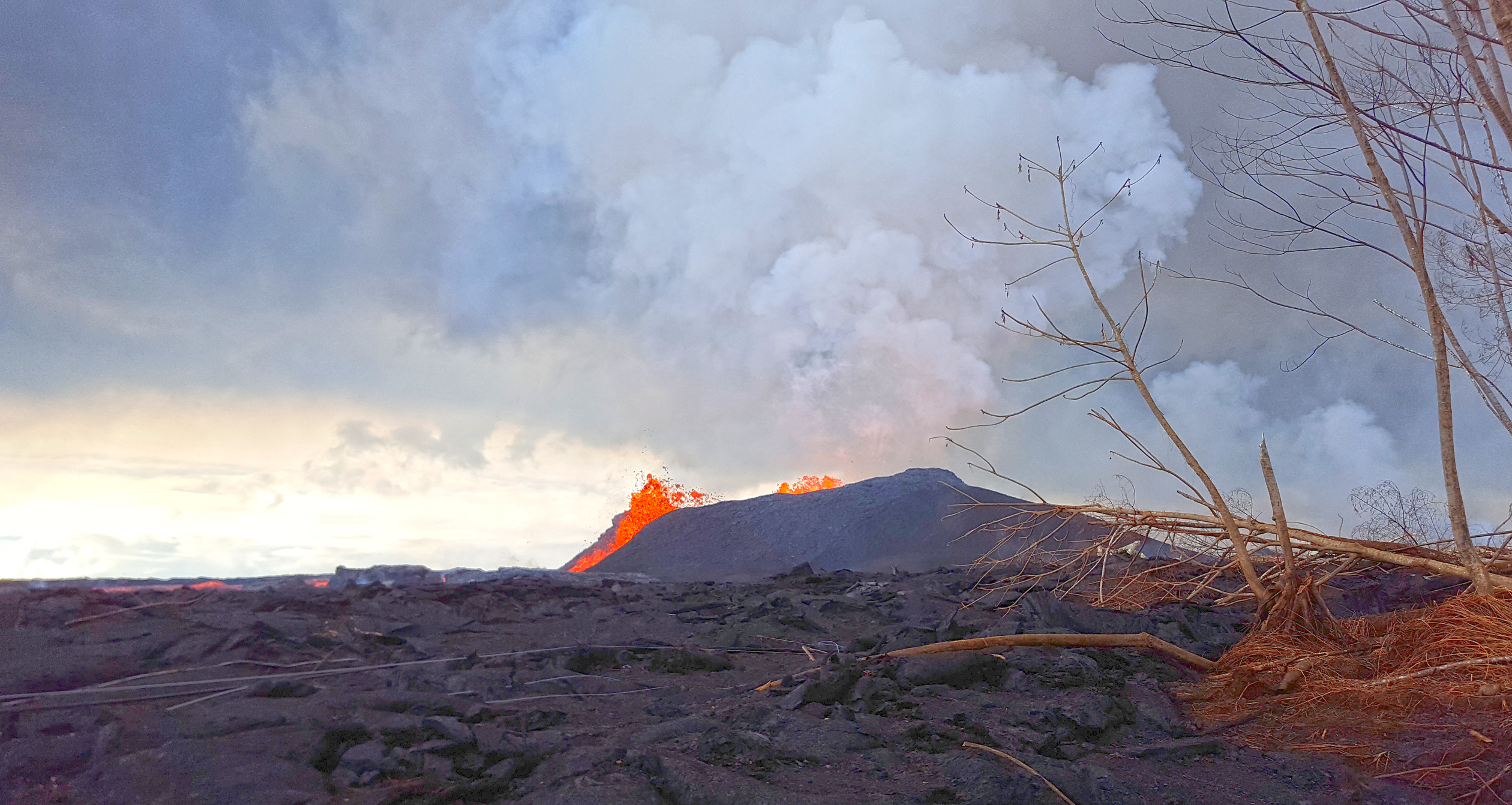
June 17, 2018
A morning overflight of the lower East Rift Zone shows the location of the fissure 8 fountain and lava channel.
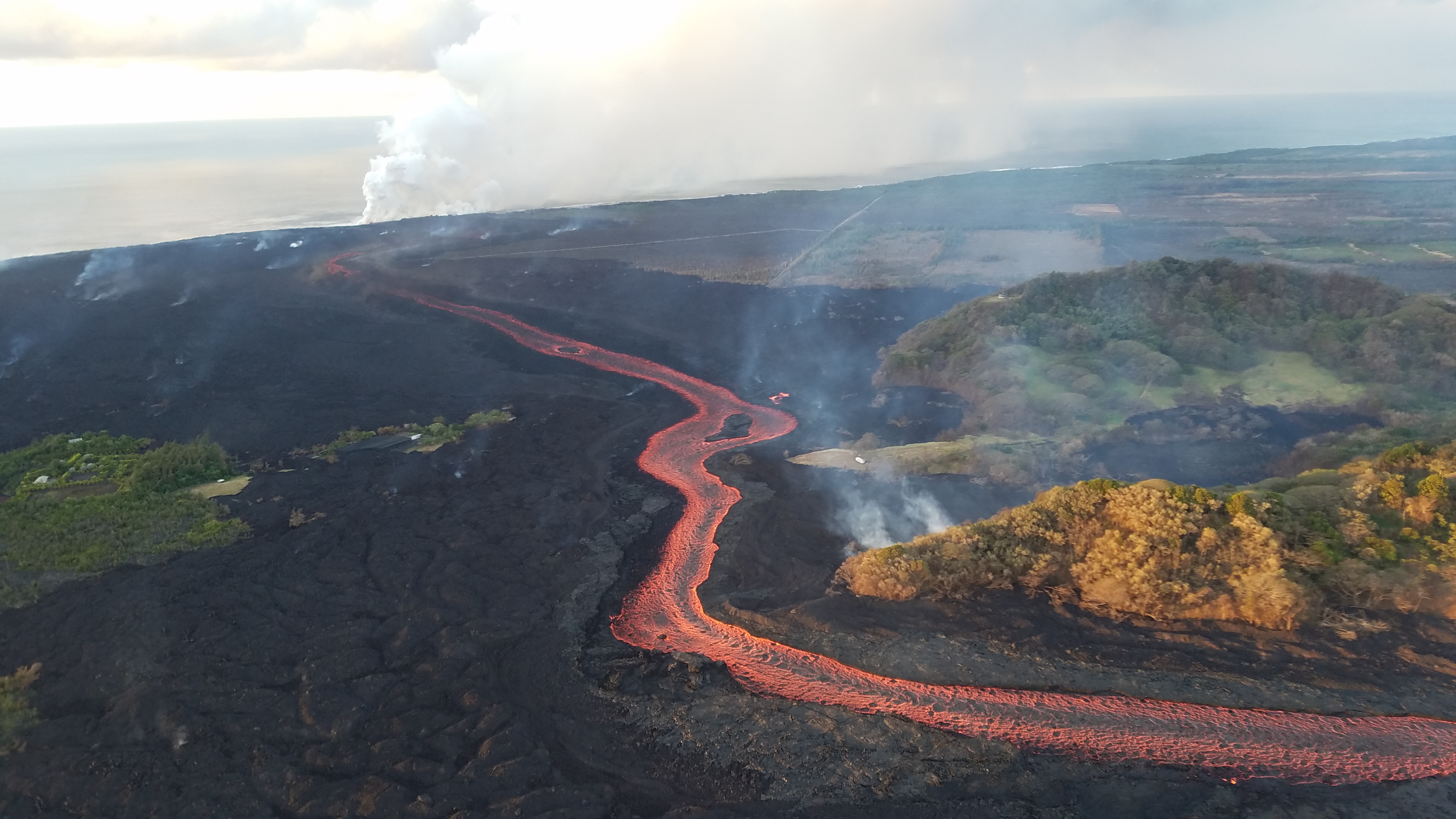
June 18, 2018
Lava from Fissure 8 flows in an open channel to the ocean.
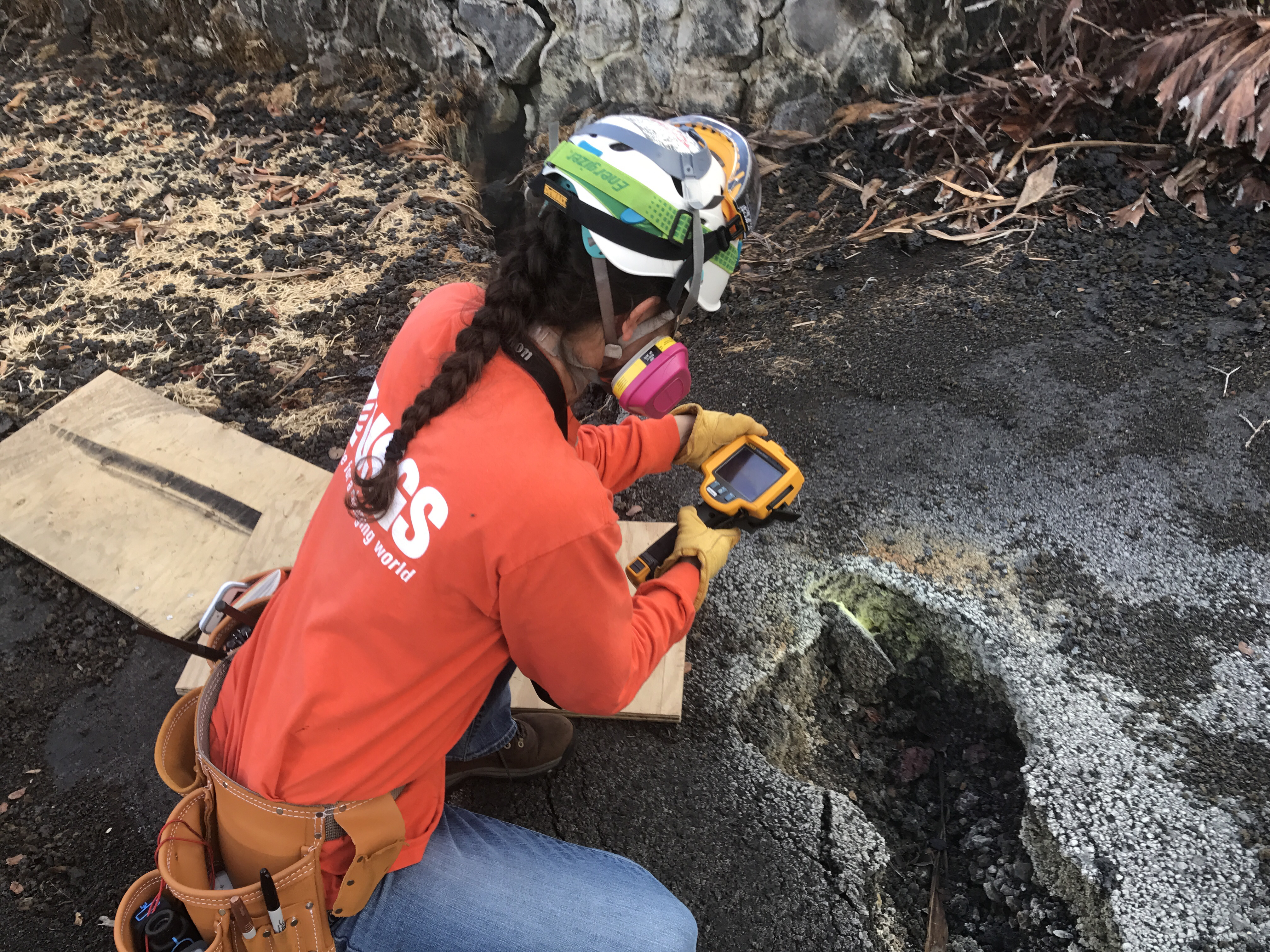
June 18, 2018
A geologist measures the temperature of a ground crack near Fissure 9.
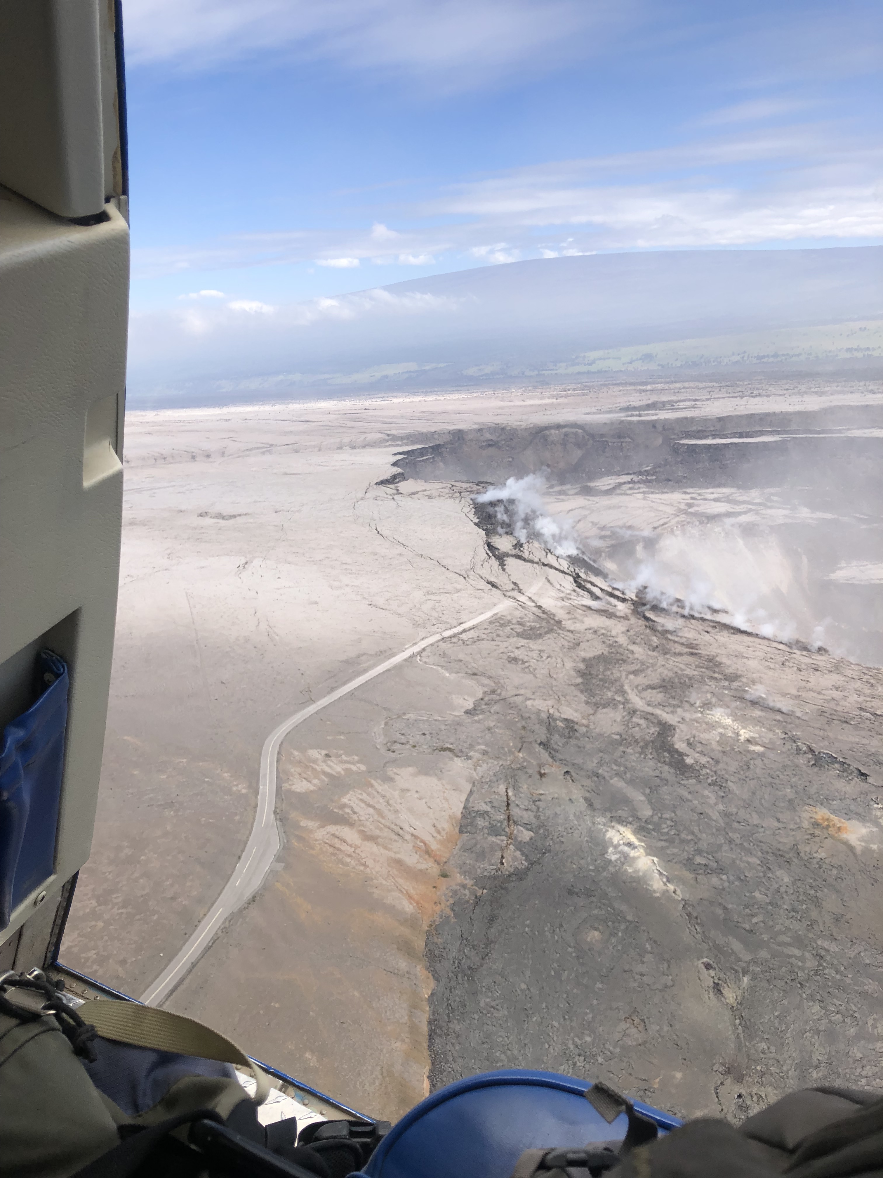
June 20, 2018
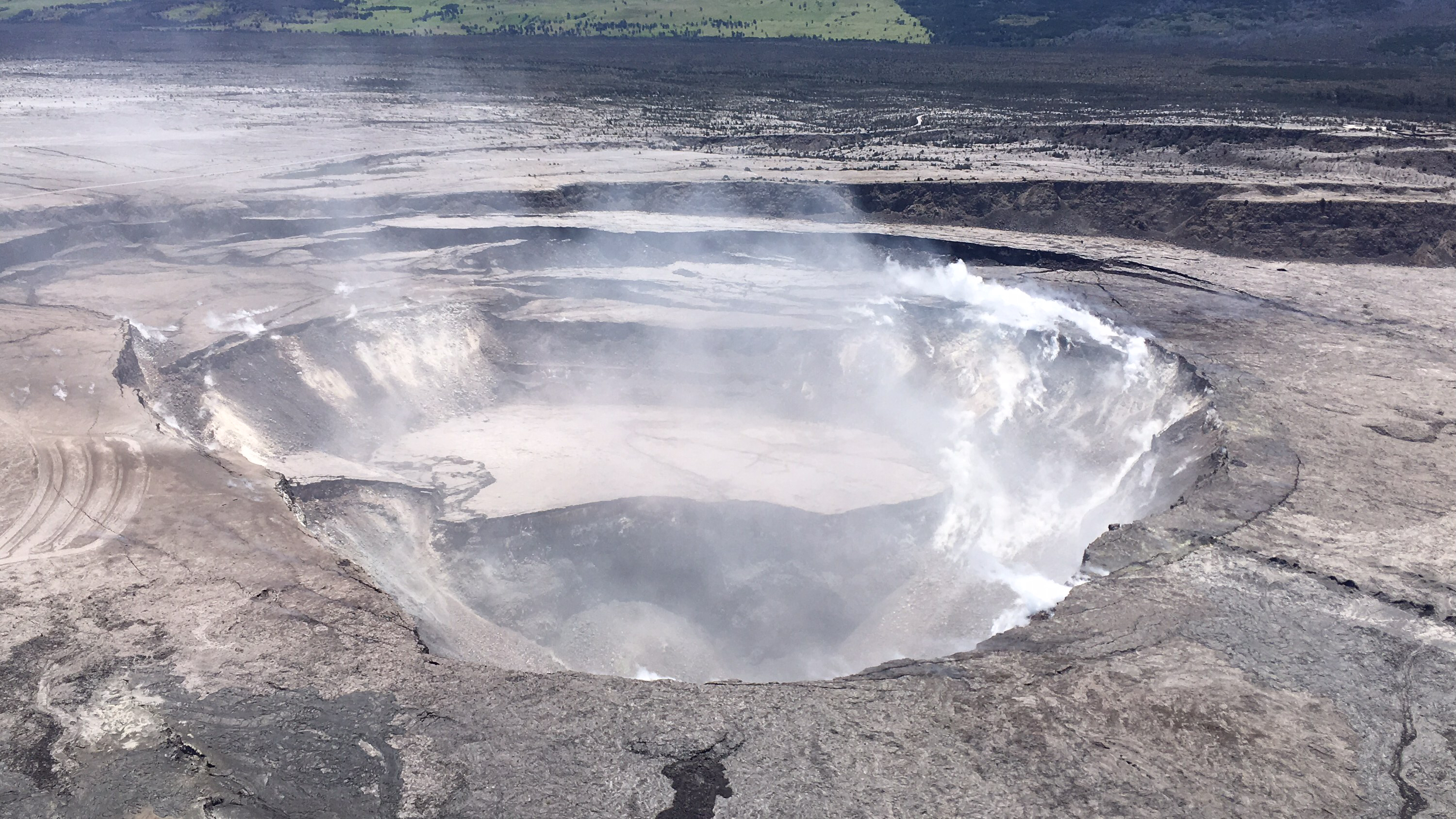
The parking lot has fallen into the crater during the past week as the Halemaʻumaʻu Crater continues to grow.
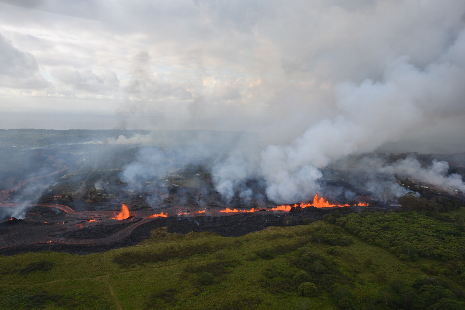
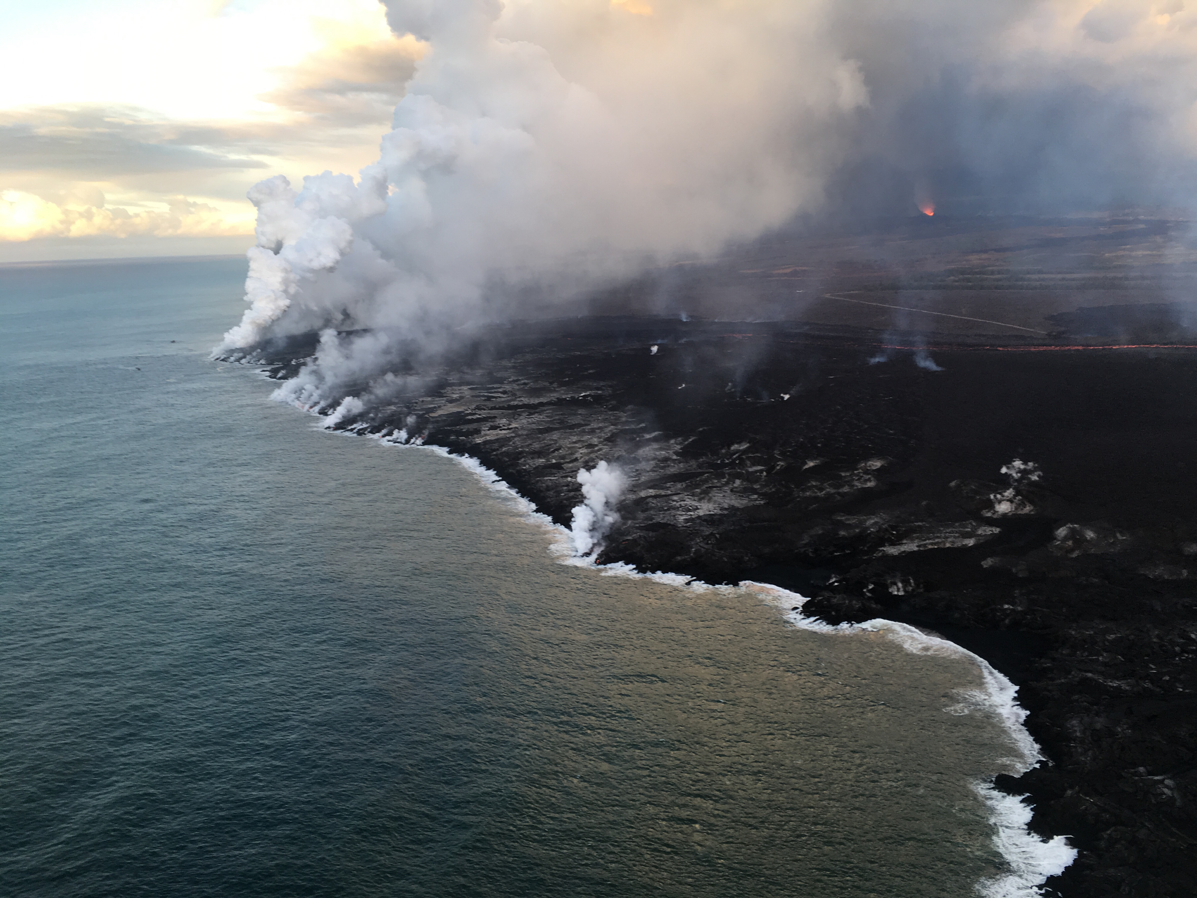
June 21, 2018
Lava from Fissure 8 continues to enter the ocean and add new landscape to the island. The fissure is visible in the background.
Source of all photos, maps, and video: U.S. Geological Survey