May 2, 2018 Map

This map shows the area of increased earthquake activity along East Rift Zone of Kīlauea Volcano from April 30 to May 2, 2018.
Source: U.S. Geological Survey
Eruption in Leilani Estates
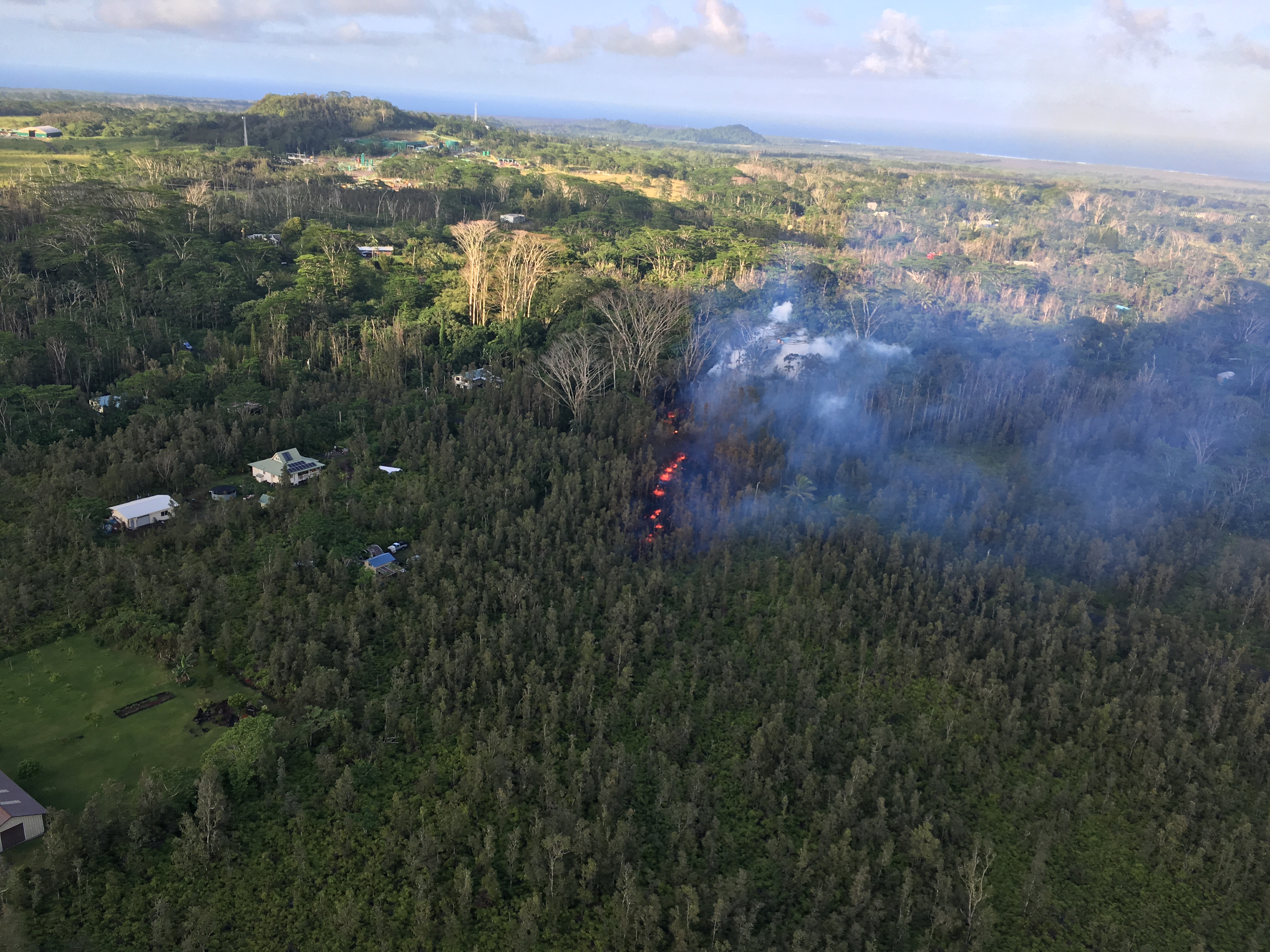
On May 3, 2018, a new eruption of Kīlauea Volcano began in the Leilani Estates neighborhood located in the lower East Rift Zone. Lava, hot water vapor, and gas fumes started spewing into the air from a newly-opened crack in the earth and lava flowed slowly outward about 10 meters from this volcanic fissure.
Source: U.S. Geological Survey
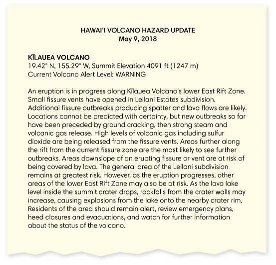
Hawaiʻi Volcano Hazard Update
Evacuation and Road Closure Map
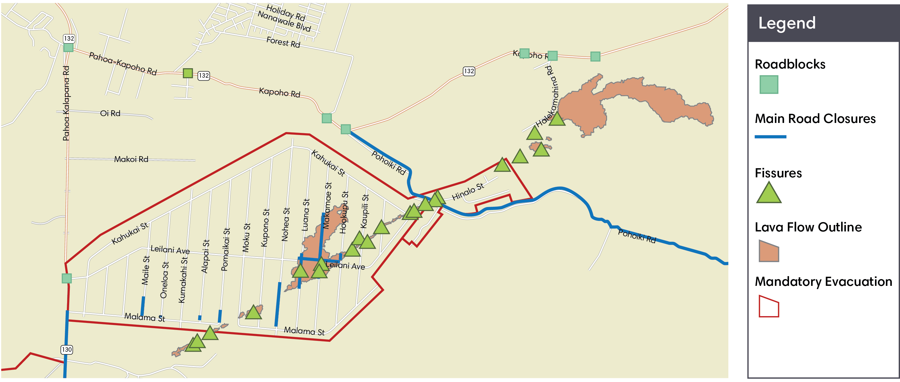
This map shows roadblocks, road closures, and mandatory evacuation areas along Kīlauea Volcano’s East Rift Zone in mid May, 2018.
Source: Adapted from County of Hawaiʻi