| Kīlauea Volcano East Rift Zone – May 4, 2018 | |
|---|---|
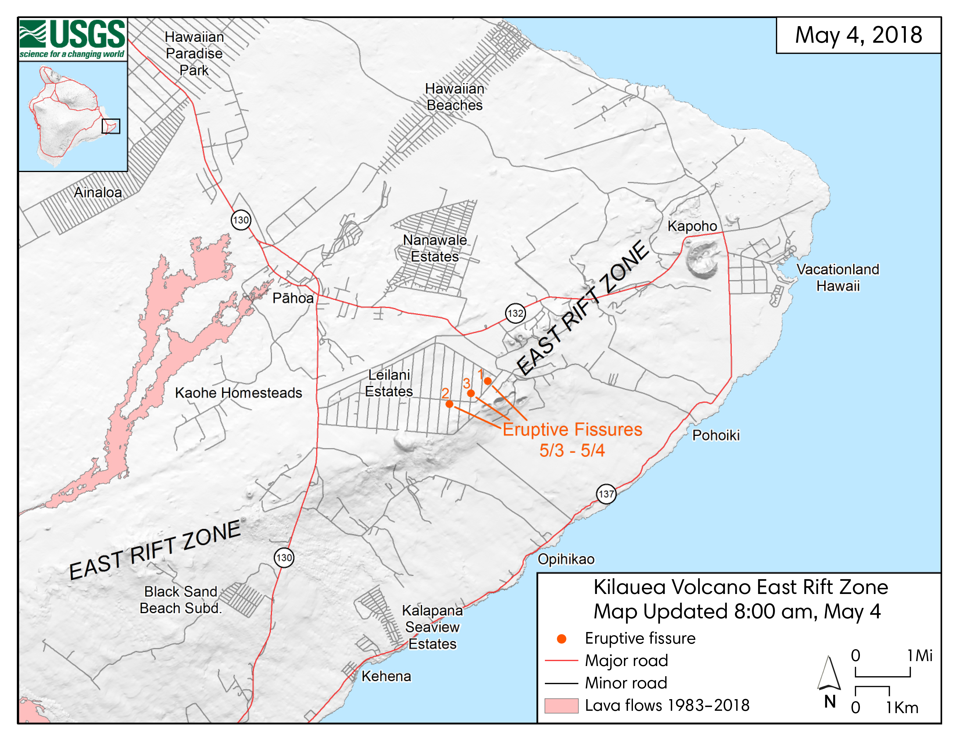 |
Description: This map shows the locations of fissure 1 (opened May 3) and fissures 2 and 3 (opened May 4) in Kīlauea Volcano's East Rift Zone. Source: U.S. Geological Survey |
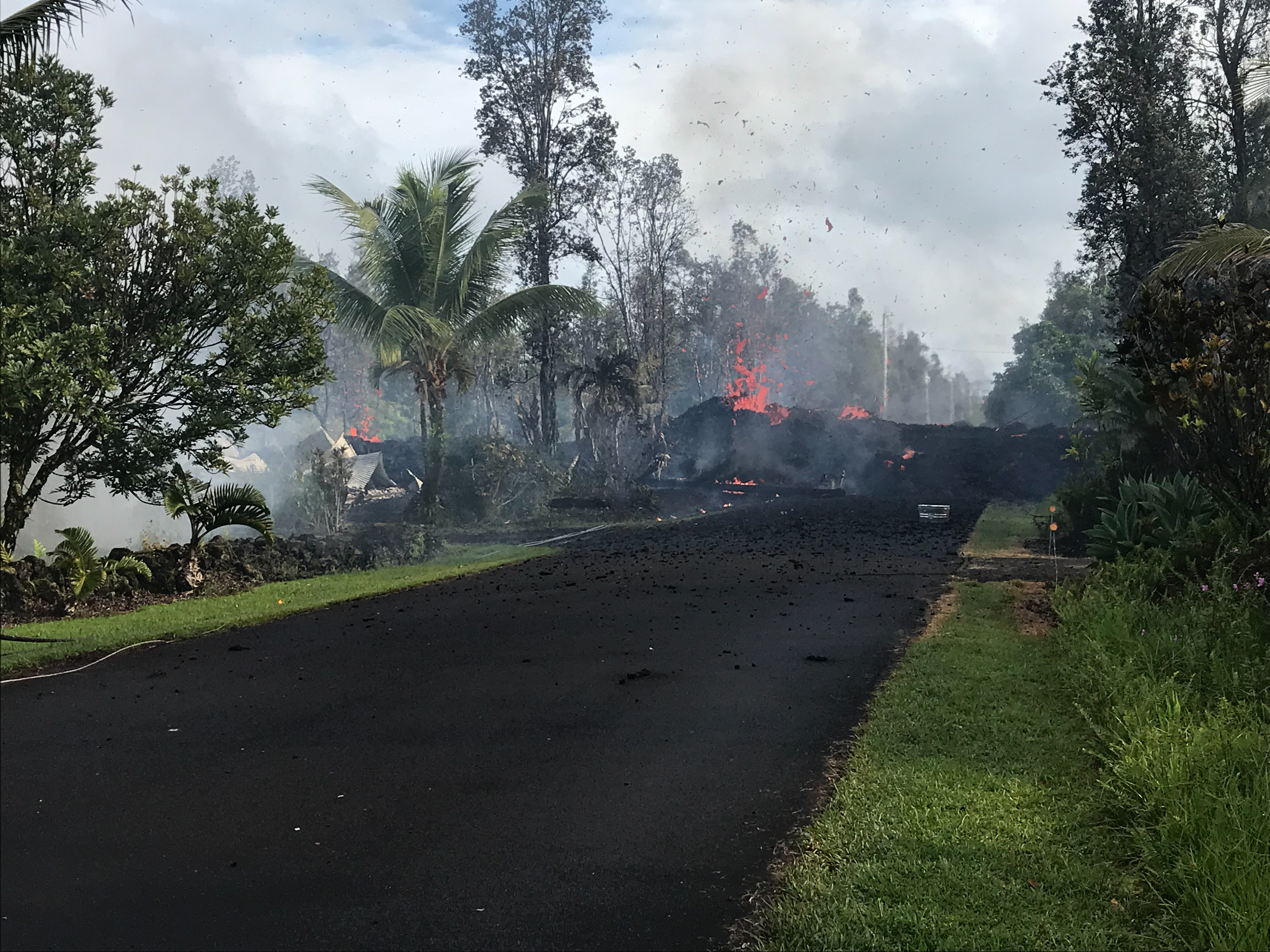 |
Description: This photo, taken at 8:07 AM on May 4, 2018, shows lava and gas spewing from fissure 3 at Leilani and Kaupili Streets in the Leilani Estates neighborhood. Lava on the road was approximately 2 m (~6.5 ft) high. Image credit: U.S. Geological Survey |
| Kīlauea Volcano East Rift Zone – May 5, 2018 | |
 |
Description: This satellite image shows fissures 1–5 and lava-covered areas of Leilani Estates in Kīlauea Volcano’s East Rift Zone on May 5, 2018. Source: U.S. Geological Survey Satellite image ©2018 DigitalGlobe, a Maxar company |
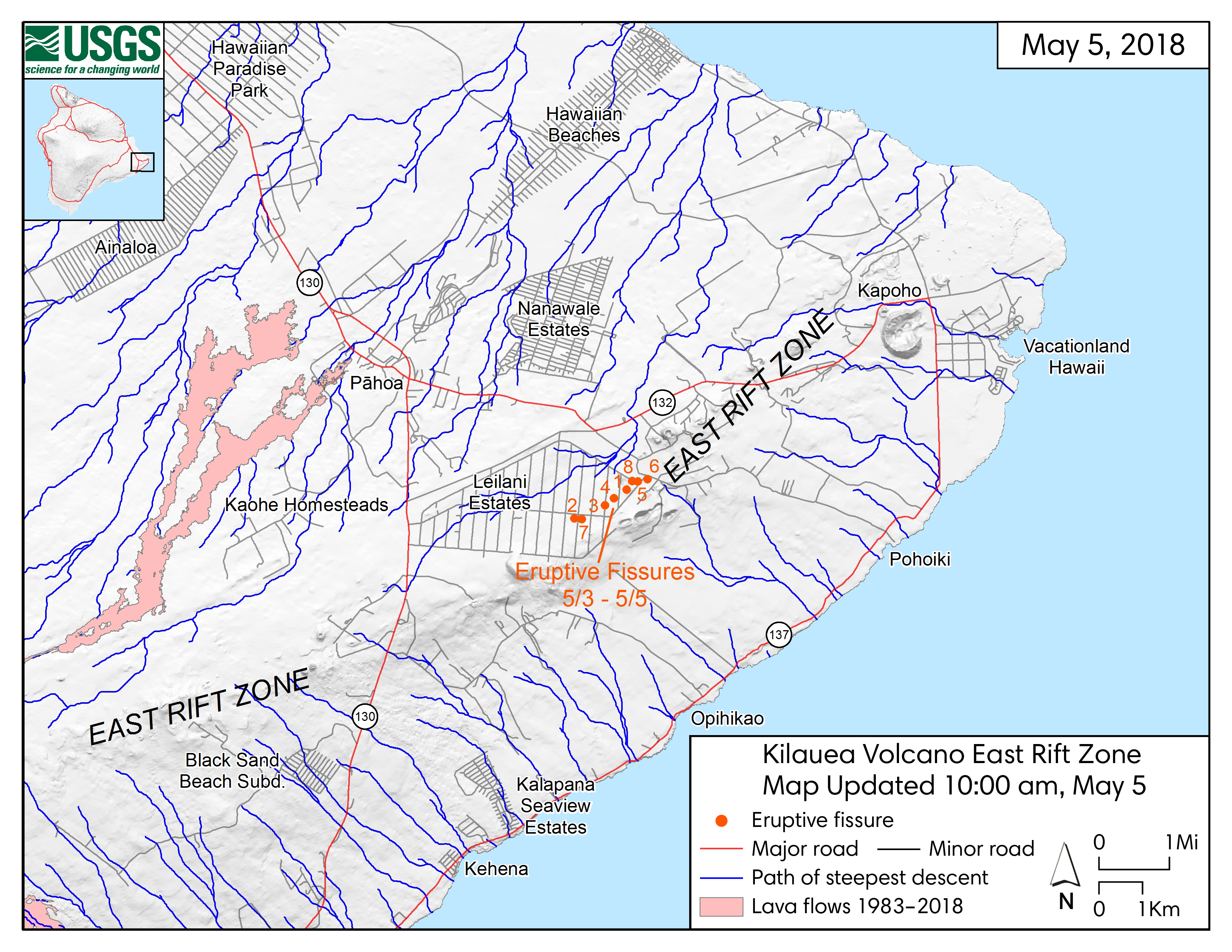 |
Description: This map shows locations of fissures 7–8 (opened May 5), along with previously-opened fissures 1–6. The blue lines show the paths of steepest descent. Source: U.S. Geological Survey |
 |
Description: This photo shows a newly opened crack on Pohoiki road in Leilani Estates on May 5, 2018. Image Credit: U.S. Geological Survey |
| Kīlauea Volcano East Rift Zone – May 6, 2018 | |
 |
Description: This thermal map, created at 2:30 PM on May 6, 2018, shows fissures 9–10 (opened May 6) along with previously-opened fissures 1–8 in Kīlauea Volcano’s East Rift Zone. The thermal image is the black portion at the center. It is shown over a color satellite image of the area. Lava flow is shown in grey and white. The hottest temperatures appear as the brightest white areas. Source: U.S. Geological Survey Satellite image ©2018 DigitalGlobe, a Maxar company |
| Kīlauea Volcano East Rift Zone – May 9, 2018 | |
 |
Description: This thermal map, created at 5:30 PM on May 9, 2018, shows fissures 1–15 in Kīlauea Volcano’s East Rift Zone. Fissures 11–12 opened May 7, fissures 13–14 opened May 8, and fissure 15 opened May 9. The thermal image is the black portion at the center. It is shown over a color satellite image of the area. Lava flow is shown in grey and white. The hottest temperatures appearing as the brightest white areas. Source: U.S. Geological Survey Satellite image ©2018 DigitalGlobe, a Maxar company |
  |
Description: The photo on the left shows a geologist from the Hawaiian Volcano Observatory (HVO) measuring the temperature at cracks in Nohea Street in Leilani Estates at 11:47 AM on May 9, 2018. The temperature reading was 103°C (218°F). The photo on the right shows deep cracks, burned trees, and gas around fissure 14. Image credits: U.S. Geological Survey |
| Kīlauea Volcano Summit Caldera – May 6, 2018 | |
|---|---|
 |
Description: This photo shows the Kīlauea Volcano’s summit crater. The level of the lava lake dropped significantly below the crater rim. Source: U.S. Geological Survey |
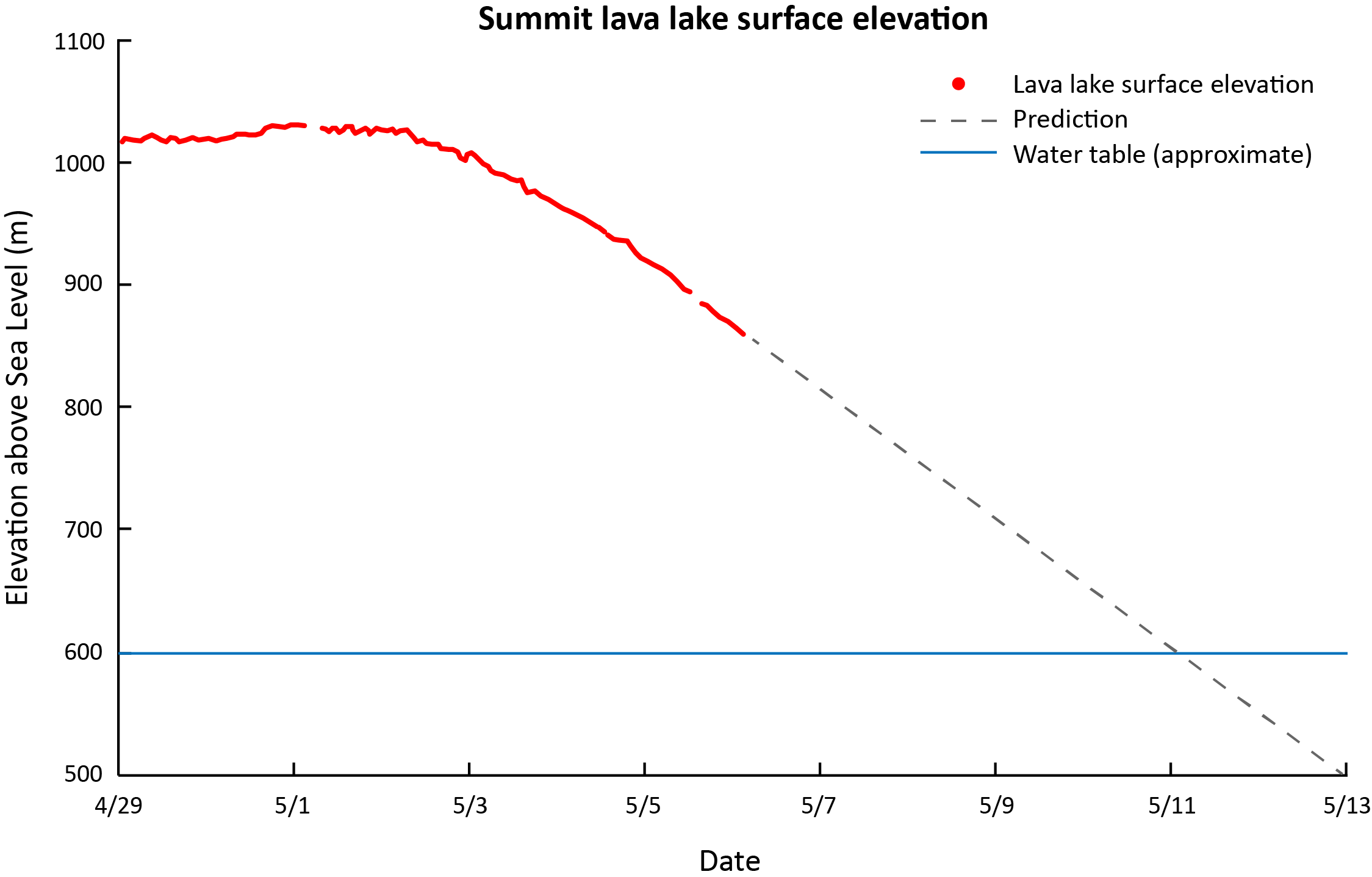 |
Description: This is a graph of the lava lake level at the Kiīlauea Volcano summit caldera. Data marked in red shows the lava lake level from April 29 to May 6, 2018. The dotted line shows predicted levels. Source: Adapted from U.S. Geological Survey |
| Kīlauea Volcano Map | |
|---|---|
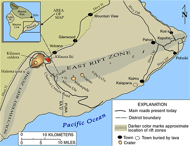 |
Description: This map of Kīlauea Volcano shows the summit caldera as well as rift zones and craters downhill from the summit. Source: U.S. Geological Survey |